
|
Last update at: May 6, 2024, 06:22 PM
Go to Top
Go to Top
Go to Top
Go to Top
Go to Top
Go to Top
Go to Top
Go to Top
Go to Top
Go to Top
Go to Top
Go to Top
Go to Top
Go to Top
Go to Top
|
Frequently Asked Questions Printer Friendly Version |
|
Closures & Advisories Search Conditions By Map Search By City Search By Route Search By District Variable Speed Limits Chain Law Neighboring States |

| District Comments | |
|---|---|
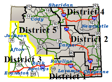
| District 3 (Southwest) | WY22: No Trailer Traffic and Weight Limit of 60,000 GVW is in effect over Teton Pass between Jackson and the Idaho state line from milepost 7 to 17. WY22: Multiple stalled vehicles, Travel lane blocked between Jackson and the Idaho state line from milepost 9 to 13, Expect delays. US30: Watch for falling rock between Kemmerer and Cokeville from milepost 36 to 38. |
| Interstate 80 | |||||||
|---|---|---|---|---|---|---|---|
| Town | Location | Conditions | Advisories | Restrictions | Last Report Time | Cameras | Sensors |
|
Evanston
NWS Forecast |
EASTBOUND between the Utah State Line and Evanston | Dry | None |
I 80 , US 189 from milepost 4.400 to 4.600 Width restriction: 18 ft |
May 6, 2024, 06:22 PM |

|

|
| WESTBOUND between the Utah State Line and Evanston | Dry | None | None | May 6, 2024, 06:22 PM |
|
|
|
| Between Evanston and Exit 18, US 189 | Dry with Strong Winds | None | None | May 6, 2024, 06:22 PM |
|
|
|
| Between Exit 18, US 189 and Exit 30, Bigelow Rd | Dry with Strong Winds | None | None | May 6, 2024, 06:22 PM |
|
|
|
|
Lyman
NWS Forecast |
Between Exit 30, Bigelow Rd and Exit 39, WY 412/414 | Dry | None | None | May 6, 2024, 06:22 PM | ||
| Between Exit 39, WY 412/414 and MM 57, Sweetwater County Line | Dry with Strong Winds | None | None | May 6, 2024, 06:22 PM |
|
|
|
|
Granger
NWS Forecast |
Between MM 57, Uinta County Line and Exit 66, Granger Jct | Dry with Strong Winds | None | None | May 6, 2024, 06:22 PM |
|
|
| Between Exit 66, Granger Jct and Exit 83, La Barge Rd | Dry with Strong Winds | None | None | May 6, 2024, 06:22 PM |
|
|
|
|
Rock Springs
NWS Forecast |
Between Exit 83, La Barge Rd and Exit 91, Flaming Gorge Way | Dry with Strong Winds | None | None | May 6, 2024, 06:22 PM |
|
|
| Between Exit 91, Flaming Gorge Way and Exit 104, Rock Springs | Dry with Strong Winds | None | None | May 6, 2024, 06:22 PM | |||
| Between Exit 104, Rock Springs and Exit 111, Airport and Baxter Roads | Dry with Strong Winds | None | None | May 6, 2024, 06:22 PM | |||
| Between Exit 111, Airport and Baxter Roads and Point of Rocks | Dry with Dangerous Winds | Extreme Blow Over Risk |
Closed to Light, High Profile Vehicles due to Extreme blowover risk. All high profile vehicles under 40,000 GVW are restricted.
|
May 6, 2024, 06:22 PM |
|
|
|
|
Patrick Draw
NWS Forecast |
Between Point of Rocks and Exit 142, Bitter Creek | Dry with Dangerous Winds | Extreme Blow Over Risk |
Closed to Light, High Profile Vehicles due to Extreme blowover risk. All high profile vehicles under 40,000 GVW are restricted.
|
May 6, 2024, 06:22 PM |
|
|
| Between Exit 142, Bitter Creek and Exit 158, Tipton Rd | Dry with Dangerous Winds | Extreme Blow Over Risk |
Closed to Light, High Profile Vehicles due to Extreme blowover risk. All high profile vehicles under 40,000 GVW are restricted.
|
May 6, 2024, 06:22 PM |
|
|
|
|
Wamsutter
NWS Forecast |
Between Exit 158, Tipton Rd and Wamsutter | Dry with Dangerous Winds | Extreme Blow Over Risk |
Closed to Light, High Profile Vehicles due to Extreme blowover risk. All high profile vehicles under 40,000 GVW are restricted.
|
May 6, 2024, 06:22 PM |
|
|
| Between Wamsutter and Exit 187, Creston Jct | Dry with Dangerous Winds | Extreme Blow Over Risk |
Closed to Light, High Profile Vehicles due to Extreme blowover risk. All high profile vehicles under 40,000 GVW are restricted.
|
May 6, 2024, 06:22 PM |
|
|
|
|
Afton
NWS Forecast Afton |
|||||||
|---|---|---|---|---|---|---|---|
| Route | Location | Conditions | Advisories | Restrictions | Last Report Time | Cameras | Sensors |
| US 26 | Between the Idaho State Line and Alpine Jct | Wet | None | None | May 6, 2024, 06:22 PM |
|
|
| US 89 | Between the Idaho State Line and Afton | Dry | None | None | May 6, 2024, 06:22 PM |
|
|
| Between Afton and Alpine Jct | Wet | None | None | May 6, 2024, 06:22 PM |
|
||
| WY 236 | Between US 89 and Fairview | Dry | None | None | May 6, 2024, 06:22 PM | ||
| WY 237 | Between Grover and Auburn | Dry | None | None | May 6, 2024, 06:22 PM | ||
| WY 238 | Between US 89 and Afton | Dry | None | None | May 6, 2024, 06:22 PM | ||
| WY 239 | Between US 89 and Freedom | Dry | None |
WY 239 at milepost 0.940 Single unit 6+ axles: 32T |
May 6, 2024, 06:22 PM | ||
|
Cokeville
NWS Forecast Cokeville |
|||||||
|---|---|---|---|---|---|---|---|
| Route | Location | Conditions | Advisories | Restrictions | Last Report Time | Cameras | Sensors |
| US 30 / WY 89 | Between Border Jct and Cokeville | Dry | None | None | May 6, 2024, 06:22 PM | ||
| Between Cokeville and Sage Jct | Dry | None | None | May 6, 2024, 06:22 PM | |||
| Between Sage Jct and Mile Marker 38, County Rd 209 | Dry | None | None | May 6, 2024, 06:22 PM |
|
|
|
| WY 232 | Between Cokeville and Button Flat | Dry | None | None | May 6, 2024, 06:22 PM | ||
| WY 89 | Between the Utah State Line and Sage Jct | Dry | None | None | May 6, 2024, 06:22 PM | ||
| Between Border Jct and the Idaho State Line | Dry | None | None | May 6, 2024, 06:22 PM |
|
||
|
Evanston
NWS Forecast Evanston |
|||||||
|---|---|---|---|---|---|---|---|
| Route | Location | Conditions | Advisories | Restrictions | Last Report Time | Cameras | Sensors |
| I 80 / US 189 | between the Utah State Line and Evanston | Dry | None |
I 80 , US 189 from milepost 4.400 to 4.600 Width restriction: 18 ft |
May 6, 2024, 06:22 PM |
|
|
| between the Utah State Line and Evanston | Dry | None | None | May 6, 2024, 06:22 PM |
|
|
|
| Between Evanston and Exit 18, US 189 | Dry with Strong Winds | None | None | May 6, 2024, 06:22 PM |
|
|
|
| Between Exit 18, US 189 and Exit 30, Bigelow Rd | Dry with Strong Winds | None | None | May 6, 2024, 06:22 PM |
|
|
|
| US 189 | Between I-80 and WY 412 | Dry | None | None | May 6, 2024, 06:22 PM |
|
|
| WY 150 | Between Evanston and the Utah State Line | Wet, Slick in Spots | None | None | May 6, 2024, 06:22 PM | ||
| WY 89 | Between Evanston and the Utah State Line | Dry | None | None | May 6, 2024, 06:22 PM | ||
|
Farson
NWS Forecast Farson |
|||||||
|---|---|---|---|---|---|---|---|
| Route | Location | Conditions | Advisories | Restrictions | Last Report Time | Cameras | Sensors |
| US 191 | Between Mile Marker 12, Yellowstone Rd and Farson | Dry | None | None | May 6, 2024, 06:22 PM |
|
|
| Between Farson and WY 351 | Dry | None | None | May 6, 2024, 06:22 PM |
|
|
|
| WY 28 | Between WY 372 and Farson | Dry | None | None | May 6, 2024, 06:22 PM |
|
|
| Between Farson and the Fremont/Sublette Cty Line | Dry with Dangerous Winds | Extreme Blow Over Risk |
Closed to Light, High Profile Vehicles
|
May 6, 2024, 06:22 PM |
|
|
|
|
Granger
NWS Forecast Granger |
|||||||
|---|---|---|---|---|---|---|---|
| Route | Location | Conditions | Advisories | Restrictions | Last Report Time | Cameras | Sensors |
| I 80 | Between MM 57, Uinta County Line and Exit 66, Granger Jct | Dry with Strong Winds | None | None | May 6, 2024, 06:22 PM |
|
|
| Between Exit 66, Granger Jct and Exit 83, La Barge Rd | Dry with Strong Winds | None | None | May 6, 2024, 06:22 PM |
|
|
|
| US 30 | Between Opal and I-80, Granger Jct | Dry | None | None | May 6, 2024, 06:22 PM |
|
|
| WY 372 | Between I-80 and WY 28 | Dry | None | None | May 6, 2024, 06:22 PM |
|
|
| WY 374 | Between I-80 and US 30 | Dry | None | None | May 6, 2024, 06:22 PM | ||
| Between I-80, Little America and WY 372 | Dry | None | None | May 6, 2024, 06:22 PM |
|
||
|
Jackson
NWS Forecast Jackson |
|||||||
|---|---|---|---|---|---|---|---|
| Route | Location | Conditions | Advisories | Restrictions | Last Report Time | Cameras | Sensors |
| US 189/191 | Between Bondurant and Hoback Jct | Wet with Snowfall | Falling Rock | None | May 6, 2024, 06:22 PM | ||
| US 26/89 | Between Alpine Jct and Hoback Jct | Wet with Snowfall, Strong Winds | Falling Rock | None | May 6, 2024, 06:22 PM |
|
|
| Between Hoback Jct and Jackson | Wet with Snowfall | None |
W BROADWAY AVE, US 26 , US 89 , US 189 , US 191 from milepost 152.090 to 155.210 Width restriction: 15 ft Height restriction: 15 ft Length restriction: 90 ft |
May 6, 2024, 06:22 PM |
|
||
| Between Jackson and the S Boundary of Grand Teton Nat'l Park | Wet with Snowfall | None |
W BROADWAY AVE, US 26 , US 89 , US 189 , US 191 from milepost 152.090 to 155.210 Width restriction: 15 ft Height restriction: 15 ft Length restriction: 90 ft |
May 6, 2024, 06:22 PM | |||
| Between the S Boundary of Grand Teton Nat'l Park and Airport Junction Road | Dry | None | None | May 6, 2024, 06:22 PM | |||
| Between Airport Junction Road and Moose | Dry | None | None | May 6, 2024, 06:22 PM | |||
| Between Moose and Moran Jct | Dry | None | None | May 6, 2024, 06:22 PM | |||
| Between Moran Jct and the E Boundary of Grand Teton Nat'l Park | Dry | None | None | May 6, 2024, 06:22 PM | |||
| US 89/191/287 | Between Moran Jct and Flagg Ranch | Dry | None | None | May 6, 2024, 06:22 PM | ||
| Between Flagg Ranch and the S Boundary of Yellowstone Nat'l Park |
Road Closed Due To Seasonal Closure As of May 06 at 05:30 a.m., the estimated opening time is between 12:00 p.m. and 02:00 p.m. on May 10. Parking on the roadway is prohibited and delays WYDOT from opening the road. |
May 6, 2024, 06:22 PM | |||||
| WY 22 | Between Jackson and Wilson | Wet with Snowfall | None |
WY 22 from milepost 6.000 to 17.490 Weight restriction: 60000 lbs |
May 6, 2024, 06:22 PM |
|
|
| Between Wilson and the Idaho State Line |
Road Closed Due To Winter Conditions and Crashes As of May 06 at 06:22 p.m., the estimated opening time is unknown. Parking on the roadway is prohibited and delays WYDOT from opening the road. |
May 6, 2024, 06:22 PM |
|
|
|||
| WY 390 | Between WY 22 and Teton Village | Wet with Snowfall | None | None | May 6, 2024, 06:22 PM | ||
|
Kemmerer
NWS Forecast Kemmerer |
|||||||
|---|---|---|---|---|---|---|---|
| Route | Location | Conditions | Advisories | Restrictions | Last Report Time | Cameras | Sensors |
| US 189 | Between WY 412 and Kemmerer | Dry | None | None | May 6, 2024, 06:22 PM |
|
|
| Between Kemmerer and WY 372 | Dry | None | None | May 6, 2024, 06:22 PM |
|
||
| US 30 | Between Mile Marker 38, County Rd 209 and Kemmerer | Dry | None | None | May 6, 2024, 06:22 PM |
|
|
| Between Kemmerer and Opal | Dry | None | None | May 6, 2024, 06:22 PM |
|
||
| WY 233 | Between Kemmerer and End of State Route | Dry | None |
WY 233 at milepost 4.430 Single unit 2-3 axles: 21T , Single unit 4-5 axles: 22T , Single unit 6+ axles: 26T , Semi-trailer combos: 37T , Truck & full trailer combos: 38T |
May 6, 2024, 06:22 PM | ||
| WY 240 | Between Opal and US 189 | Dry | None | None | May 6, 2024, 06:22 PM |
|
|
|
La Barge
NWS Forecast La Barge |
|||||||
|---|---|---|---|---|---|---|---|
| Route | Location | Conditions | Advisories | Restrictions | Last Report Time | Cameras | Sensors |
| US 189 | Between WY 372 and La Barge | Dry | None | None | May 6, 2024, 06:22 PM | ||
| Between La Barge and Big Piney | Dry | None |
US 189 at milepost 104.840 Single unit 6+ axles: 34T |
May 6, 2024, 06:22 PM | |||
| WY 235 | Between La Barge and Calpet | Dry | None | None | May 6, 2024, 06:22 PM | ||
| WY 350 | Between Big Piney and End of State Route | Dry | None | None | May 6, 2024, 06:22 PM | ||
| WY 372 | Between WY 28 and US 189 | Dry with Strong Winds | None | None | May 6, 2024, 06:22 PM |
|
|
|
Lyman
NWS Forecast Lyman |
|||||||
|---|---|---|---|---|---|---|---|
| Route | Location | Conditions | Advisories | Restrictions | Last Report Time | Cameras | Sensors |
| I 80 | Between Exit 30, Bigelow Rd and Exit 39, WY 412/414 | Dry | None | None | May 6, 2024, 06:22 PM | ||
| Between Exit 39, WY 412/414 and MM 57, Sweetwater County Line | Dry with Strong Winds | None | None | May 6, 2024, 06:22 PM |
|
|
|
| WY 410 | Between Mountain View and End of State Route | Dry | None |
WY 410 at milepost 15.540 Single unit 4-5 axles: 25T , Single unit 6+ axles: 31T , Semi-trailer combos: 39T |
May 6, 2024, 06:22 PM | ||
| WY 411 | Between WY 410 and Millburne | Dry | None | None | May 6, 2024, 06:22 PM | ||
| WY 412 | Between I-80 and US 189 | Dry | None | None | May 6, 2024, 06:22 PM | ||
| WY 414 | Between I-80, Carter Int and the Utah State Line | Dry | None | None | May 6, 2024, 06:22 PM |
|
|
|
Patrick Draw
NWS Forecast Patrick Draw |
|||||||
|---|---|---|---|---|---|---|---|
| Route | Location | Conditions | Advisories | Restrictions | Last Report Time | Cameras | Sensors |
| I 80 / US 30 | Between Point of Rocks and Exit 142, Bitter Creek | Dry with Dangerous Winds | Extreme Blow Over Risk |
Closed to Light, High Profile Vehicles due to Extreme blowover risk. All high profile vehicles under 40,000 GVW are restricted.
|
May 6, 2024, 06:22 PM |
|
|
| Between Exit 142, Bitter Creek and Exit 158, Tipton Rd | Dry with Dangerous Winds | Extreme Blow Over Risk |
Closed to Light, High Profile Vehicles due to Extreme blowover risk. All high profile vehicles under 40,000 GVW are restricted.
|
May 6, 2024, 06:22 PM |
|
|
|
|
Pinedale
NWS Forecast Pinedale |
|||||||
|---|---|---|---|---|---|---|---|
| Route | Location | Conditions | Advisories | Restrictions | Last Report Time | Cameras | Sensors |
| US 189 | Between Big Piney and Daniel Jct | Dry | None | None | May 6, 2024, 06:22 PM |
|
|
| Between Daniel Jct and Bondurant | Wet | None | None | May 6, 2024, 06:22 PM |
|
|
|
| US 191 | Between WY 351 and Pinedale | Dry | None |
US 191 at milepost 88.230 Single unit 6+ axles: 33T |
May 6, 2024, 06:22 PM |
|
|
| Between Pinedale and Daniel Jct | Dry | None | None | May 6, 2024, 06:22 PM |
|
||
| WY 351 | Between US 189 and US 191 | Dry | None | None | May 6, 2024, 06:22 PM |
|
|
| WY 352 | Between US 191 and Bridger Teton Nat'l Forest | Dry | None | None | May 6, 2024, 06:22 PM |
|
|
| WY 353 | Between US 191 and End of State Route | Dry | None | None | May 6, 2024, 06:22 PM | ||
|
Rock Springs
NWS Forecast Rock Springs |
|||||||
|---|---|---|---|---|---|---|---|
| Route | Location | Conditions | Advisories | Restrictions | Last Report Time | Cameras | Sensors |
| I 80 / US 30 | Between Exit 83, La Barge Rd and Exit 91, Flaming Gorge Way | Dry with Strong Winds | None | None | May 6, 2024, 06:22 PM |
|
|
| Between Exit 91, Flaming Gorge Way and Exit 104, Rock Springs | Dry with Strong Winds | None | None | May 6, 2024, 06:22 PM | |||
| Between Exit 104, Rock Springs and Exit 111, Airport and Baxter Roads | Dry with Strong Winds | None | None | May 6, 2024, 06:22 PM | |||
| Between Exit 111, Airport and Baxter Roads and Point of Rocks | Dry with Dangerous Winds | Extreme Blow Over Risk |
Closed to Light, High Profile Vehicles due to Extreme blowover risk. All high profile vehicles under 40,000 GVW are restricted.
|
May 6, 2024, 06:22 PM |
|
|
|
| US 191 | Between Mile Marker 513 and Mile Marker 502, Southbound Closure Gate |
Road Closed Due To Winter Conditions As of May 06 at 09:20 a.m., the estimated opening time is unknown. Parking on the roadway is prohibited and delays WYDOT from opening the road. |
May 6, 2024, 06:22 PM |
|
|||
| Between the Utah State Line and Mile Marker 513 |
Road Closed Due To Winter Conditions As of May 06 at 09:20 a.m., the estimated opening time is unknown. Parking on the roadway is prohibited and delays WYDOT from opening the road. |
May 6, 2024, 06:22 PM | |||||
| Between Mile Marker 502, Southbound Closure Gate and I-80 | Slick in Spots with Blowing Snow | None | None | May 6, 2024, 06:22 PM | |||
| Between Rock Springs and Mile Marker 12, Yellowstone Rd | Dry | None | None | May 6, 2024, 06:22 PM | |||
| WY 371 | Between I-80 and Superior | Dry | None | None | May 6, 2024, 06:22 PM | ||
| WY 374 | Between WY 372 and Green River | Dry with Strong Winds | None | None | May 6, 2024, 06:22 PM |
|
|
| WY 430 | Between Rock Springs and the Colorado State Line | Dry with Strong Winds | None | None | May 6, 2024, 06:22 PM |
|
|
| WY 530 | Between Green River and the Utah State Line | Dry | None | None | May 6, 2024, 06:22 PM | ||
|
Wamsutter
NWS Forecast Wamsutter |
|||||||
|---|---|---|---|---|---|---|---|
| Route | Location | Conditions | Advisories | Restrictions | Last Report Time | Cameras | Sensors |
| I 80 / US 30 | Between Exit 158, Tipton Rd and Wamsutter | Dry with Dangerous Winds | Extreme Blow Over Risk |
Closed to Light, High Profile Vehicles due to Extreme blowover risk. All high profile vehicles under 40,000 GVW are restricted.
|
May 6, 2024, 06:22 PM |
|
|
| Between Wamsutter and Exit 187, Creston Jct | Dry with Dangerous Winds | Extreme Blow Over Risk |
Closed to Light, High Profile Vehicles due to Extreme blowover risk. All high profile vehicles under 40,000 GVW are restricted.
|
May 6, 2024, 06:22 PM |
|
|
|
|
NWS Forecast |
|||||||
|---|---|---|---|---|---|---|---|
| Route | Location | Conditions | Advisories | Restrictions | Last Report Time | Cameras | Sensors |
|
NWS Forecast |
|||||||
|---|---|---|---|---|---|---|---|
| Route | Location | Conditions | Advisories | Restrictions | Last Report Time | Cameras | Sensors |
| *Chain Law - Level 1 Definition |
| **Chain Law - Level 2 Definition |
| Other Definitions |
| Impact Levels | Description / Recommended Action |
|---|---|
| Low | Minimal impacts expected, use general caution. |
| Moderate | Some impacts expected, use extra caution. Stay alert for changing road and weather conditions. |
| High | Dangerous impacts expected, use extreme caution, delay travel or consider alternate route. If travel is necessary, slow down and allow extra time. |
| CLOSED | Per W.S. 24-1-109, motorists traveling on a closed road without permission from WYDOT or WHP may be subject to a fine of up to $750 and/or up to 30 days imprisonment. |
| Seasonal / Long-Duration Event | Impact level used to distinguish long-duration events from emergent events. |
|
|
|
| Citizen | Business | Government | Visitor | Contact Us | Copyright © 2024 State of Wyoming | Disclaimer | Privacy Policy | Media |
| Production Laramie v. 1.2.0.1750-20240429 | ||||||||